A closer look at what the data shows
Aligning with trends identified in previous research, the fire weather data show that climate change will increase the frequency and severity of fire weather across Canada. Notably, the data indicates a greater than 25% increase in the intensity of locally “high” fire weather[1] conditions for most regions of Canada by end of century under the high emissions scenario (RCP8.5). The data also indicates that fire seasons are likely to get longer, and the frequency of very high fire weather conditions is likely to grow as temperatures increase.
Importantly, these data only show changes in fire weather. Other factors that combine to determine the pattern, frequency and intensity of wildfires in a region, including available fuel, land-use type, and ignition sources, are not captured by these data. A large city in southern Canada outside of a forested area may register high fire weather values; however, the large amount of cement and buildings and the sparsity of trees mean these locations are unlikely to be engulfed by wildfire.
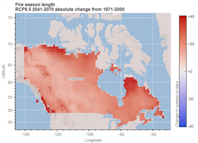
Below is an example of what the application can display. This map shows the absolute change in projected fire season length in Canada for the 30-year period 2041-2070, compared to the average fire season length for the baseline period 1971-2000, in a high emissions scenario (RCP8.5). Read more about emissions scenarios here: Emissions Scenarios: RCPs — ClimateData.ca.