What are the similarities and differences between the M6 and U6 datasets?
Both M6 and U6 datasets include daily minimum and maximum temperature and precipitation data, which have been used to derive the 30+ climate indices available on ClimateData.ca. The main differences between the original U6 and improved M6 datasets are the statistical downscaling techniques and target datasets used. The M6 dataset also includes an additional emissions scenario, SSP3-7.0.
Statistical downscaling techniques
M6 is a multivariate dataset that was derived using a statistical downscaling technique called n-dimensional Multivariate Bias Correction (MBCn), which prioritizes preserving the relationships between climate variables. This technique increases confidence particularly for indices such as freeze-thaw cycles and snowfall, which are derived from both temperature and precipitation.The previously available downscaled dataset, U6, is a univariate dataset, meaning that downscaling is performed for each climate variable independently, in this case using the BCCAQv2 downscaling method. This method is highly effective for downscaling a single variable at a time, such as daily maximum temperature.
The target dataset
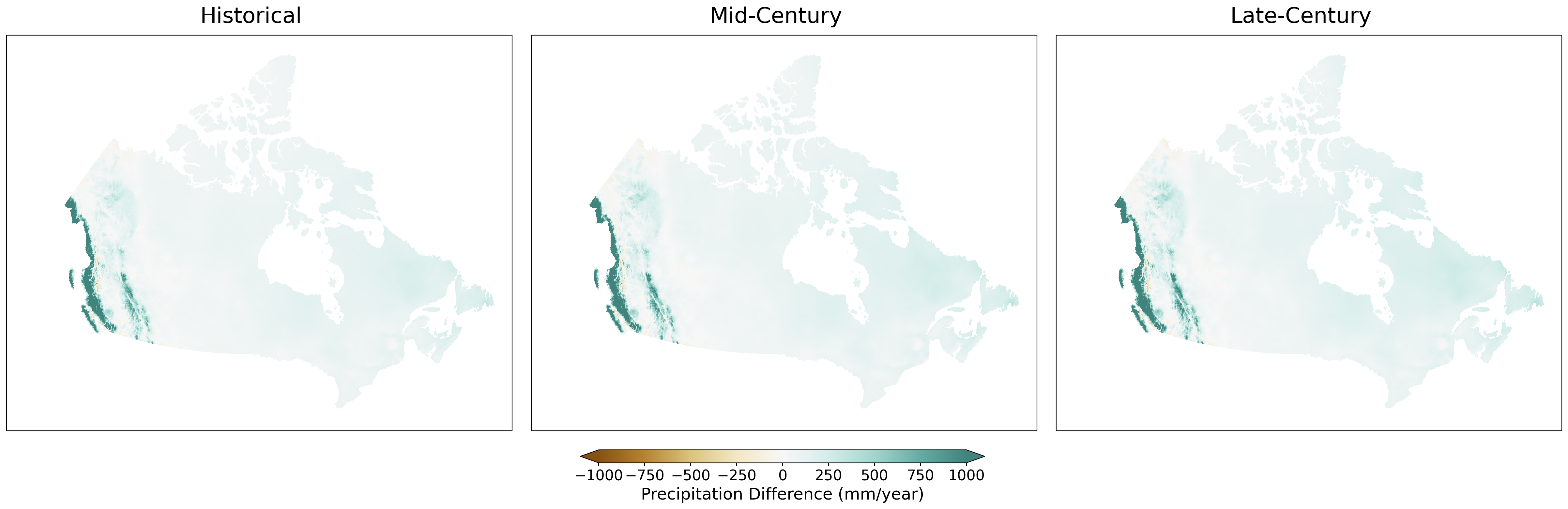
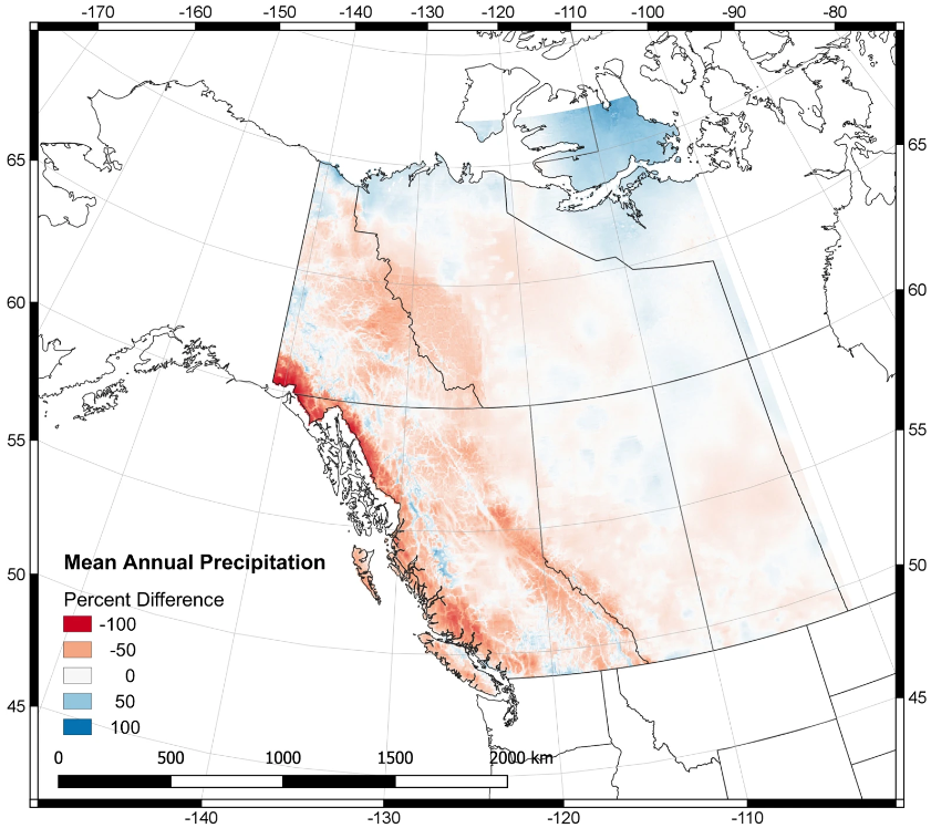
A target dataset is a set of high-resolution historical data used to adjust climate model simulations to better reflect local climate conditions.U6 uses NRCANmet V1 as the target dataset3,4. This dataset is produced by Natural Resources Canada, and is available at a gridded spatial resolution of approximately 6 x 10 km (it is also commonly referred to as “ANUSPLIN”).M6 uses an improved target dataset, PCIC-Blend, which has the same spatial resolution as NRCANmet. This dataset was developed by the Pacific Climate Impacts Consortium (PCIC) by combining pre-existing datasets that each have their own advantages in certain parts of the country. PCIC-Blend combines PNWNAmet over western Canada (daily maximum and minimum temperature, precipitation) with NRCANmet V2 (daily maximum and minimum temperature) and NRCANmet-Adjusted (precipitation) over central and eastern Canada3. The three datasets were smoothly blended over a transition region east of the Rocky Mountains from the Arctic Ocean to the US border. While the NRCANmet datasets provide a good description of these variables over central and eastern Canada, PNWNAmet performs better in the west when compared to station observations.Learn more about the M6 dataset by reading the article, Multivariate Canadian Downscaled Climate Scenarios for CMIP6 (CanDCS- M6).
New emissions scenario
M6 includes the three emissions scenarios in U6 (SSP1-2.6, SSP2-4.5, SSP5-8.5) plus a fourth scenario, SSP3-7.0. Results are available for the same 26 GCMs in the U6 ensemble, except for SSP3-7.0, where only 24 of the 26 models were available.