All Variables

Below is a library of all variables available within ClimateData.ca. Use the filter to limit your search to specific types of data.

The Hottest Day describes the warmest daytime temperature in the selected time period. In general, the hottest day of the year occurs during the summer months.

High temperatures are important. They determine if plants and animals can thrive, they limit or enable outdoor activities, define how we design our buildings and vehicles, and shape our transportation and energy use. However, when temperatures are very hot, people – especially the elderly – are much more likely to suffer from heat exhaustion and heat stroke. Many outdoor activities become dangerous or impossible in very high temperatures.

Technical Description:

The highest maximum temperature (Tmax) in the selected time period. Use the Variable menu option to view annual, monthly or seasonal values for this index.


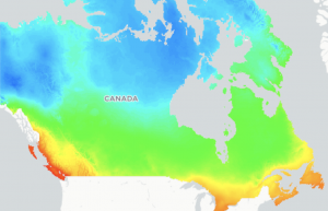
Mean temperature describes the average temperature for the 24-hour day.

The average temperature is an environmental indicator with many applications in agriculture, engineering, health, energy management, recreation, and more.

Technical description:

The average of the daily maximum temperature (Tmax) and the daily minimum temperature (Tmin). Use the Variable menu option to view annual, monthly or seasonal values for this variable.

Minimum temperature describes the coldest temperature of the 24-hour day. Typically, but not always, the minimum temperature occurs at night and so this variable is commonly referred to as the nighttime low.

The average lowest temperature is an environmental indicator with many applications in agriculture, engineering, health, energy management, recreation, and more.

Technical description:

The daily minimum temperature (Tmin). Use the Variable menu option to view annual, monthly or seasonal values for this variable.

Maximum temperature describes the warmest temperature of the 24-hour day. Typically, but not always, the maximum temperatures occur during the day and so this variable is commonly referred to as the daytime high.

The average highest temperature is an environmental indicator with many applications in agriculture, engineering, health, energy management, recreation, and more.

Technical description:

The daily maximum temperature (Tmax). Use the Variable menu option to view annual, monthly or seasonal values for this variable.

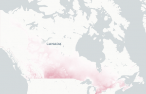
Days with Max Humidex > 30 describes the number of days where the Humidex is greater than 30. This index gives an indication of the number of hot and humid days in the selected time period.

The Humidex was developed by the Meteorological Service of Canada to describe how hot and humid the weather feels to the average person. In Canada, it is recommended that outdoor activities be moderated when the Humidex exceeds 30, and that all unnecessary activities cease when it passes 40 (Environment and Climate Change Canada, 2019).

Technical description:

The number of days with a maximum Humidex (HX) over 30.

Use the Variable menu option to view annual, monthly or seasonal values for this index.

Read more

Humidex projections (developed by Environment and Climate Change Canada)

Humidex combines the temperature and humidity into one number to reflect the perceived temperature. Because it takes into account the two most important factors that affect summer comfort, it can be a better measure of how the weather affects the human body than either temperature or humidity alone.

Humidex is widely used in Canada. In the past, extremely high values were rare except in the southern regions of Ontario, Manitoba and Quebec, as well as southern sections of Alberta and Saskatchewan.  Generally, the Humidex decreases as latitude increases.

Projections are available at a resolution of 0.1° (approximately 9 km) from 1950-2100.

Scenario and model uncertainty

Uncertainty in the amount of greenhouse gases that will be emitted over the coming century is represented by providing results for multiple emissions scenarios (SSP1-26, SSP2-45 and SSP5-85). Climate model uncertainty is represented by providing the 10th, 50th, and 90th percentile of results across a 19-member model ensemble (see below for the full list).

Methods

Following the results of Diaconescu et al. (2022), daily maximum temperature and daily minimum relative humidity from CMIP6 GCMs were statistically downscaled and bias corrected using the N-dimensional probability density function transform multivariate quantile mapping method (Cannon, 2018) against ERA5-Land (Muñoz, 2019) hourly temperature and relative humidity at the time of daily maximum Humidex. The bias-corrected temperature and relative humidity values were next used in the following equations to compute daily maximum Humidex:

\text{Humidex} = T_a + \frac{5}{9}(\rho - 10) \\ \text{Where:} \\ \rho = 6.112 x 10^{7.5*T_a/(237.7+T_a)}*\text{RH}/100, \\ T_a = \text{air temperature (°C)}, \\ RH = \text{relative humidity}


References

Cannon, A. J. (2018). ‘Multivariate quantile mapping bias correction: an N-dimensional probability density function transform for climate model simulations of multiple variables’, Climate Dynamics, 50(1-2), 31-49. Available at https://doi.org/10.1007/s00382-017-3580-6

Diaconescu, E. P. et al. (2022) ‘A short note on the use of daily climate data to calculate Humidex heat-stress indices’, International Journal of Climatology, 1– 13. https://doi.org/10.1002/joc.7833

Environment and Climate Change Canada. (2019) Warm Season Weather Hazards.

Muñoz Sabater, J., 2019: ERA5-Land hourly data from 1981 to present. Copernicus Climate Change Service (C3S) Climate Data Store (CDS).

List of models

Institution Model name Realization
CSIRO-ARCCSS (Australia) ACCESS-CM2 r1i1p1f1
CSIRO (Australia) ACCESS-ESM1-5 r1i1p1f1
CNRM-CERFACS (France) CNRM-CM6-1 r1i1p1f2
CNRM-CERFACS (France) CNRM-ESM2-1 r1i1p1f2
CCCma (Canada) CanESM5 r1i1p1f1
CMCC (Italy) CMCC-ESM2 r1i1p1f1
EC-Earth-Consortium (Europe) EC-Earth3 r1i1p1f1
EC-Earth-Consortium (Europe) EC-Earth3-Veg r1i1p1f1
EC-Earth-Consortium (Europe) EC-Earth3-Veg-LR r1i1p1f1
CAS (China) FGOALS-g3 r1i1p1f1
NASA-GISS (USA) GISS-E2-1-G r1i1p1f2
INM (Russia) INM-CM4-8 r1i1p1f1
INM (Russia) INM-CM5-0 r1i1p1f1
IPSL (France) IPSL-CM6A-LR r1i1p1f1
MIROC (Japan) MIROC-ES2L r1i1p1f2
MIROC (Japan) MIROC6 r1i1p1f1
DKRZ (Germany) MPI-ESM1-2-HR r1i1p1f1
MPI-M (Germany) MPI-ESM1-2-LR r1i1p1f1
MRI (Japan) MRI-ESM2-0 r1i1p1f1

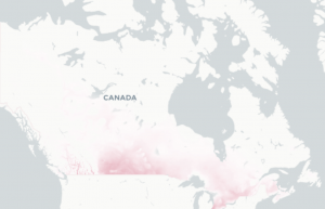
Days with Max Humidex > 35 describes the number of days where the Humidex is greater than 35. This index gives an indication of the number of hot and humid days in the selected time period.

The Humidex was developed by the Meteorological Service of Canada to describe how hot and humid the weather feels to the average person. In Canada, it is recommended that outdoor activities be moderated when the Humidex exceeds 30, and that all unnecessary activities cease when it passes 40 (Environment and Climate Change Canada, 2019).

Technical description:

The number of days with a maximum Humidex (HX) over 35.

Use the Variable menu option to view annual, monthly or seasonal values for this index.

Read more

Humidex projections (developed by Environment and Climate Change Canada)

Humidex combines the temperature and humidity into one number to reflect the perceived temperature. Because it takes into account the two most important factors that affect summer comfort, it can be a better measure of how the weather affects the human body than either temperature or humidity alone.

Humidex is widely used in Canada. In the past, extremely high values were rare except in the southern regions of Ontario, Manitoba and Quebec, as well as southern sections of Alberta and Saskatchewan.  Generally, the Humidex decreases as latitude increases.

Projections are available at a resolution of 0.1° (approximately 9 km) from 1950-2100.

Scenario and model uncertainty

Uncertainty in the amount of greenhouse gases that will be emitted over the coming century is represented by providing results for multiple emissions scenarios (SSP1-26, SSP2-45 and SSP5-85). Climate model uncertainty is represented by providing the 10th, 50th, and 90th percentile of results across a 19-member model ensemble (see below for the full list).

Methods

Following the results of Diaconescu et al. (2022), daily maximum temperature and daily minimum relative humidity from CMIP6 GCMs were statistically downscaled and bias corrected using the N-dimensional probability density function transform multivariate quantile mapping method (Cannon, 2018) against ERA5-Land (Muñoz, 2019) hourly temperature and relative humidity at the time of daily maximum Humidex. The bias-corrected temperature and relative humidity values were next used in the following equations to compute daily maximum Humidex:

\text{Humidex} = T_a + \frac{5}{9}(\rho - 10) \\ \text{Where:} \\ \rho = 6.112 x 10^{7.5*T_a/(237.7+T_a)}*\text{RH}/100, \\ T_a = \text{air temperature (°C)}, \\ RH = \text{relative humidity}


References

Cannon, A. J. (2018). ‘Multivariate quantile mapping bias correction: an N-dimensional probability density function transform for climate model simulations of multiple variables’, Climate Dynamics, 50(1-2), 31-49. Available at https://doi.org/10.1007/s00382-017-3580-6

Diaconescu, E. P. et al. (2022) ‘A short note on the use of daily climate data to calculate Humidex heat-stress indices’, International Journal of Climatology, 1– 13. https://doi.org/10.1002/joc.7833

Environment and Climate Change Canada. (2019) Warm Season Weather Hazards.

Muñoz Sabater, J., 2019: ERA5-Land hourly data from 1981 to present. Copernicus Climate Change Service (C3S) Climate Data Store (CDS).

List of models

Institution Model name Realization
CSIRO-ARCCSS (Australia) ACCESS-CM2 r1i1p1f1
CSIRO (Australia) ACCESS-ESM1-5 r1i1p1f1
CNRM-CERFACS (France) CNRM-CM6-1 r1i1p1f2
CNRM-CERFACS (France) CNRM-ESM2-1 r1i1p1f2
CCCma (Canada) CanESM5 r1i1p1f1
CMCC (Italy) CMCC-ESM2 r1i1p1f1
EC-Earth-Consortium (Europe) EC-Earth3 r1i1p1f1
EC-Earth-Consortium (Europe) EC-Earth3-Veg r1i1p1f1
EC-Earth-Consortium (Europe) EC-Earth3-Veg-LR r1i1p1f1
CAS (China) FGOALS-g3 r1i1p1f1
NASA-GISS (USA) GISS-E2-1-G r1i1p1f2
INM (Russia) INM-CM4-8 r1i1p1f1
INM (Russia) INM-CM5-0 r1i1p1f1
IPSL (France) IPSL-CM6A-LR r1i1p1f1
MIROC (Japan) MIROC-ES2L r1i1p1f2
MIROC (Japan) MIROC6 r1i1p1f1
DKRZ (Germany) MPI-ESM1-2-HR r1i1p1f1
MPI-M (Germany) MPI-ESM1-2-LR r1i1p1f1
MRI (Japan) MRI-ESM2-0 r1i1p1f1

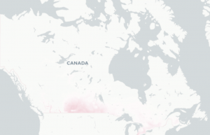
Days with Max Humidex > 40 describes the number of days where the Humidex is greater than 40. This index gives an indication of the number of hot and humid days in the selected time period.

The Humidex was developed by the Meteorological Service of Canada to describe how hot and humid the weather feels to the average person. In Canada, it is recommended that outdoor activities be moderated when the Humidex exceeds 30, and that all unnecessary activities cease when it passes 40 (Environment and Climate Change Canada, 2019) Warm Season Weather Hazards.

Technical description:

The number of days with a maximum Humidex (HX) over 40.

Use the Variable menu option to view annual, monthly or seasonal values for this index.

Read more

Humidex projections (developed by Environment and Climate Change Canada)

Humidex combines the temperature and humidity into one number to reflect the perceived temperature. Because it takes into account the two most important factors that affect summer comfort, it can be a better measure of how the weather affects the human body than either temperature or humidity alone.

Humidex is widely used in Canada. In the past, extremely high values were rare except in the southern regions of Ontario, Manitoba and Quebec, as well as southern sections of Alberta and Saskatchewan.  Generally, the Humidex decreases as latitude increases.

Projections are available at a resolution of 0.1° (approximately 9 km) from 1950-2100.

Scenario and model uncertainty

Uncertainty in the amount of greenhouse gases that will be emitted over the coming century is represented by providing results for multiple emissions scenarios (SSP1-26, SSP2-45 and SSP5-85). Climate model uncertainty is represented by providing the 10th, 50th, and 90th percentile of results across a 19-member model ensemble (see below for the full list).

Methods

Following the results of Diaconescu et al. (2022), daily maximum temperature and daily minimum relative humidity from CMIP6 GCMs were statistically downscaled and bias corrected using the N-dimensional probability density function transform multivariate quantile mapping method (Cannon, 2018) against ERA5-Land (Muñoz, 2019) hourly temperature and relative humidity at the time of daily maximum Humidex. The bias-corrected temperature and relative humidity values were next used in the following equations to compute daily maximum Humidex:

\text{Humidex} = T_a + \frac{5}{9}(\rho - 10) \\ \text{Where:} \\ \rho = 6.112 x 10^{7.5*T_a/(237.7+T_a)}*\text{RH}/100, \\ T_a = \text{air temperature (°C)}, \\ RH = \text{relative humidity}


References

Cannon, A. J. (2018). ‘Multivariate quantile mapping bias correction: an N-dimensional probability density function transform for climate model simulations of multiple variables’, Climate Dynamics, 50(1-2), 31-49. Available at https://doi.org/10.1007/s00382-017-3580-6

Diaconescu, E. P. et al. (2022) ‘A short note on the use of daily climate data to calculate Humidex heat-stress indices’, International Journal of Climatology, 1– 13. https://doi.org/10.1002/joc.7833

Environment and Climate Change Canada. (2019) Warm Season Weather Hazards.

Muñoz Sabater, J., 2019: ERA5-Land hourly data from 1981 to present. Copernicus Climate Change Service (C3S) Climate Data Store (CDS).

List of models

Institution Model name Realization
CSIRO-ARCCSS (Australia) ACCESS-CM2 r1i1p1f1
CSIRO (Australia) ACCESS-ESM1-5 r1i1p1f1
CNRM-CERFACS (France) CNRM-CM6-1 r1i1p1f2
CNRM-CERFACS (France) CNRM-ESM2-1 r1i1p1f2
CCCma (Canada) CanESM5 r1i1p1f1
CMCC (Italy) CMCC-ESM2 r1i1p1f1
EC-Earth-Consortium (Europe) EC-Earth3 r1i1p1f1
EC-Earth-Consortium (Europe) EC-Earth3-Veg r1i1p1f1
EC-Earth-Consortium (Europe) EC-Earth3-Veg-LR r1i1p1f1
CAS (China) FGOALS-g3 r1i1p1f1
NASA-GISS (USA) GISS-E2-1-G r1i1p1f2
INM (Russia) INM-CM4-8 r1i1p1f1
INM (Russia) INM-CM5-0 r1i1p1f1
IPSL (France) IPSL-CM6A-LR r1i1p1f1
MIROC (Japan) MIROC-ES2L r1i1p1f2
MIROC (Japan) MIROC6 r1i1p1f1
DKRZ (Germany) MPI-ESM1-2-HR r1i1p1f1
MPI-M (Germany) MPI-ESM1-2-LR r1i1p1f1
MRI (Japan) MRI-ESM2-0 r1i1p1f1

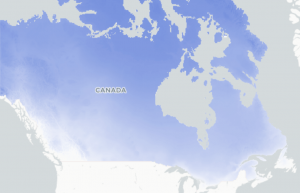
Days with Tmin <-15°C describes the number of days where the lowest temperature of the day is colder than -15°C. This index gives an indication of the number of very cold days in the selected time period.

Cold weather is an important aspect of life in Canada, and many places in Canada are well adapted to very cold winters. Cold temperatures affect our health and safety, determine what plants and animals can live in the area, limit or enable outdoor activities, define how we design our buildings and vehicles, and shape our transportation and energy use.

Technical description:

The number of days with a minimum temperature (Tmin) less than -15°C.

Use the Variable menu option to view annual, monthly or seasonal values for this index.

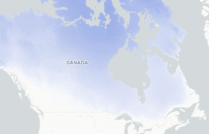
Days with Tmin <-25°C describes the number of days where the lowest temperature of the day is colder than -25°C. This index gives an indication of the number of extreme cold days in the selected time period.

Cold weather is an important aspect of life in Canada, and many places in Canada are well adapted to very cold winters. Cold temperatures affect our health and safety, determine what plants and animals can live in the area, limit or enable outdoor activities, define how we design our buildings and vehicles, and shape our transportation and energy use.

Technical description:

The number of days with a minimum temperature (Tmin) less than -25°C. Use the Variable menu option to view annual, monthly or seasonal values for this index.

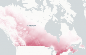
Days with Tmax > 25°C describes the number of days where the daytime high temperature is warmer than 25°C. This index gives an indication of number of summer days in the selected time period.

High temperatures are important. They determine if plants and animals can thrive, they limit or enable outdoor activities, define how we design our buildings and vehicles, and shape our transportation and energy use. However, when temperatures are very hot, people – especially the elderly – are much more likely to suffer from heat exhaustion and heat stroke. Many outdoor activities become dangerous or impossible in very high temperatures.

Technical description:

The number of days with a maximum temperature (Tmax) greater than 25°C. Use the Variable menu option to view annual, monthly or seasonal values for this index.

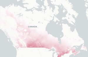
Days with Tmax > 27°C describes the number of days where the daytime high temperature is warmer than 27°C.

High temperatures are important. They determine if plants and animals can thrive, they limit or enable outdoor activities, define how we design our buildings and vehicles, and shape our transportation and energy use. However, when temperatures are very hot, people – especially the elderly – are much more likely to suffer from heat exhaustion and heat stroke. Many outdoor activities become dangerous or impossible in very high temperatures.

Technical description:

The number of days with a maximum temperature (Tmax) greater than 27°C. Use the Variable menu option to view annual, monthly or seasonal values for this index.

Days with Tmax > 29°C describes the number of days where the daytime high temperature is warmer than 29°C.

High temperatures are important. They determine if plants and animals can thrive, they limit or enable outdoor activities, define how we design our buildings and vehicles, and shape our transportation and energy use. However, when temperatures are very hot, people – especially the elderly – are much more likely to suffer from heat exhaustion and heat stroke. Many outdoor activities become dangerous or impossible in very high temperatures.

Technical description:

The number of days with a maximum temperature (Tmax) greater than 29°C. Use the Variable menu option to view annual, monthly or seasonal values for this index.

Days with Tmax > 30°C describes the number of days where the daytime high temperature is warmer than 30°C. This index gives an indication of number of hot days in the selected time period.

High temperatures are important. They determine if plants and animals can thrive, they limit or enable outdoor activities, define how we design our buildings and vehicles, and shape our transportation and energy use. However, when temperatures are very hot, people – especially the elderly – are much more likely to suffer from heat exhaustion and heat stroke. Many outdoor activities become dangerous or impossible in very high temperatures.

Technical description:

The number of days with a maximum temperature (Tmax) greater than 30°C. Use the Variable menu option to view annual, monthly or seasonal values for this index.

Days with Tmax > 32°C describes the number of days where the daytime high temperature is warmer than 32°C. This index gives an indication of number of very hot days in the selected time period.

High temperatures are important. They determine if plants and animals can thrive, they limit or enable outdoor activities, define how we design our buildings and vehicles, and shape our transportation and energy use. However, when temperatures are very hot, people – especially the elderly – are much more likely to suffer from heat exhaustion and heat stroke. Many outdoor activities become dangerous or impossible in very high temperatures.

Technical description:

The number of days with a maximum temperature (Tmax) greater than 32°C. Use the Variable menu option to view annual, monthly or seasonal values for this index.

The Coldest Day describes the lowest nighttime temperature in the selected time period. In general, the coldest day of the year occurs during the winter months.

Cold weather is an important aspect of life in Canada, and many places in Canada are well adapted to very cold winters. Cold temperatures affect our health and safety, determine what plants and animals can live in the area, limit or enable outdoor activities, define how we design our buildings and vehicles, and shape our transportation and energy use.

Technical Description:

The lowest minimum temperature (Tmin) in the selected time period. Use the Variable menu option to view monthly, seasonal and annual values for this index.

The Last Spring Frost marks the approximate beginning of the growing season for frost-sensitive crops and plants. When the lowest temperature of the day remains above 0°C for one consecutive day (before July 15th) the date of the last spring frost is established.

Technical description:

The spring date after which there are no daily minimum temperatures during the growing season less than 0°C (Tmin > 0°C). Because this variable is largely used to assess the beginning of the growing season in southern Canada, the latest possible date for a spring frost was set as July 15. Use the Variable menu option to view values for this index on the map.

The First Fall Frost marks the approximate end of the growing season for frost-sensitive crops and plants. When the lowest temperature of the day is colder than 0°C for one consecutive day (after July 15th) the date of the first fall frost is established.

Technical description:

The first date in the fall (or late summer) on which the daily minimum temperature is less than 0°C (Tmin < 0°C). Because this variable is largely used to assess the end of the growing season in southern Canada, the earliest possible date for a fall frost was set as July 15. Use the Variable menu option to view values for this index on the map.

The Frost Free Season is the approximate length of the growing season during which there are no freezing temperatures to kill or damage frost-sensitive plants. This index describes the number of days between the Last Spring Frost and the First Fall Frost.

Technical description:

The number of days between the date of the last spring frost and the date of the first fall frost, equivalent to the number of consecutive days during the ‘summer’ without any daily minimum temperatures below 0°C. Use the Variable menu option to view values for this index on the map.